


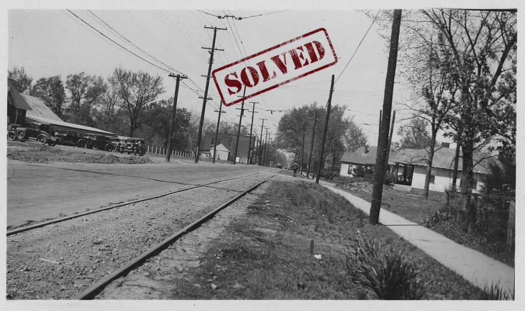
The markings on the back of this photograph indicate that it was taken on April 18, 1936 and depicts Chelsea Avenue before the street underwent a paving project. The description does not include any more specific information that would let us know where on Chelsea Avenue this spot is located. Are you able to determine where the photographer was standing back in 1936?
SOLVED!!
Phoebe Moore was the first to submit the solution to this mystery! She first pointed to a July 15, 1935 article in the Commercial Appeal archive that discussed an upcoming PWA project repaving Chelsea from Bellevue to Evergreen. Focusing her efforts on that area, she pointed to the 1938 Aerial Map, which shows a large building shaped like the one on the left with lots of cars around it near the intersection with Sylvan (Chelsea Auto Yard). This would place the photographer just east of Sylvan Street, looking west.
Glenn Bandy later confirmed this location by consulting the 1938 Aerial Map. He noted that the brick two story build in the background on the left can be seen in the aerial map at the corner of Chelsea and Bellevue. Further, by using Google Street View, we can see that the house on the right side of Chelsea is still there! You can see it on the western side of the Sylvan/Chelsea intersection, placing our photographer around 35.171365, -90.016246.